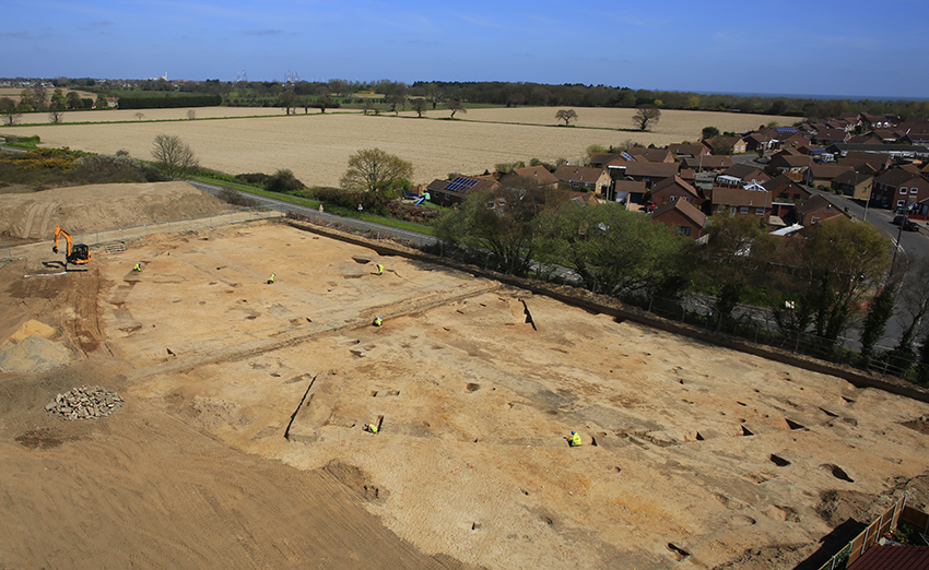
Our nationally significant site at Hopton-on-Sea, Norfolk, features in a fascinating article by Mike Pitts in the latest (May/June) edition of British Archaeology. The site lay in an area of extensive cropmarks, previously studied as part of the National Mapping Program (NMP) of the Norfolk Coastal Zone. Our findings brought details of this study into sharper focus, revealing a ceremonial landscape in use for at least two or three millennia.
“We excavate hundreds of sites every year, and are constantly reminded how little we still really know about our country’s past,” Mark Hinman, regional manager at PCA, told British Archaeology. “But even with that background, this one is special.”
The geographic and topographic position of the site are striking and particularly relevant to the results of our excavations. The site lies on the former ‘Isle of Lothingland’, with the River Yare to the north and the River Waveney to the west and south, on a south facing slope overlooking a former spring. Such locations are known to have been favoured places for settlement since the Neolithic period.
One of the most striking features of the site was a 30m diameter Neolithic ring ditch, dated using Optically Stimulated Luminescence (OSL) to 3225BC +/- 320 years, with a larger 80m diameter outer ring added in the Late Bronze Age. Various finds, including a jet stud and beaker pottery, hint at funerary activity in the earlier history of the monument and cremations demonstrate this tradition continued through the Middle to Late Bronze Age.

There was a hiatus in activity until the mid-1st Century AD, when the landscaped was redefined by a series of Roman field systems, trackways and rural farmsteads, which may initially have been laid out by the army on a surveyed grid, traces of which survive as cropmarks. These cropmarks had previously been discussed as part of the NMP, who considered the possibility they represented both prehistoric and Roman farming, but excavations have shown them to be exclusively Early Roman in date.
A rare gladius handguard plate from a military issue sword, thought to have been used in the invasion of Britain, suggests the founders of the settlement had links with the army. This rare find was recovered with an unusual pottery assemblage from one of the wells on the farm. The farmsteads went out of use by the mid 2nd Century AD, but the wider agricultural use of the landscape appears to have continued into the 3rd Century. This follows a local pattern previously recognised in North Norfolk.
We’ve excavated large areas of land ahead of redevelopment by Cripps Developments. The latest phase of work has shown that a presumed Bronze Age barrow is actually Roman, dating to the same period as the settlement. It may prove to be a temple, echoing the circular, ceremonial Bronze Age monument that dominated the landscape for so long.